 |
Langlois
is a tiny town of 400 located on the scenic southern Oregon coast. This small agricultural community has a few antique shops, and limited facilities, however it's just a twenty-minute drive from the town of Bandon. The area stretching south from Langlois is often referred to as "Little New Zealand," because of the thousands of sheep that graze on the beautiful hills and river valleys. Langlois is near Floras Lake and Boice Park, which is very popular with windsurfers. Both experts and beginnings come to Floras Lake for its sandy bottom and fresh, shallow water that makes it perfect for windsurfing. The lake is spring-fed and flows under a bridge into Floras Creek, and canoe and kayak rentals are available, as well as windsurfing lessons for all ages and ranges. Langlois and Floras Lake are separated from the ocean only by a sand dune, and this unique setting creates beautiful views and recreational opportunities. This is the spot that Sunset Magazine named as "Oregon's Loneliest Beach," which makes it perfect for beachcombing. There are nearby trails to hike or bike, secluded coves to explore, golfing at nearby Bandon Dunes, and shops, art galleries and restaurants to enjoy in Bandon's Old Town section.

|
Langlois Vacation Rentals
|

|
|
|

|
Langlois Hotels and Resorts
|

|
|

|
Langlois Weather & Climate
|

|
|
|
The Southern Oregon Coast enjoys a mild, varied climate, with only rare occurrences of severe weather such as thunderstorms, tornadoes or hailstorms. The most important geographic feature that affects the climate is the Pacific Ocean, which makes up the western border of the state. Most of the storm systems moving across Oregon have been greatly modified by traveling over the ocean. As a result, winter minimum and summer maximum temperatures on the Oregon coast are also greatly modified. The coastal region does, however, receive an abundant amount of rainfall much of the year, resulting in occasional flooding along coastal streams. This also accounts for the rich pastures and farmland along the Oregon coast. The average annual snowfall in the region is only one to three inches, and many years there is no measurable amount.
|
| Month |
High Temp |
Low Temp |
Rainfall |
Ocean Temp |
| January |
53°F |
39°F |
11.57 in. |
50°F |
| February |
54°F |
41°F |
10.13 in. |
50°F |
| March |
55°F |
41°F |
9.71 in. |
50°F |
| April |
57°F |
42°F |
6.03 in. |
50°F |
| May |
60°F |
46°F |
4.03 in. |
51°F |
| June |
64°F |
49°F |
1.91 in. |
51°F |
| July |
67°F |
52°F |
0.53 in. |
51°F |
| August |
68°F |
52°F |
1.07 in. |
52°F |
| September |
67°F |
50°F |
1.85 in. |
53°F |
| October |
63°F |
46°F |
4.69 in. |
52°F |
| November |
56°F |
43°F |
11.01 in. |
52°F |
| December |
53°F |
39°F |
11.88 in. |
51°F |

|
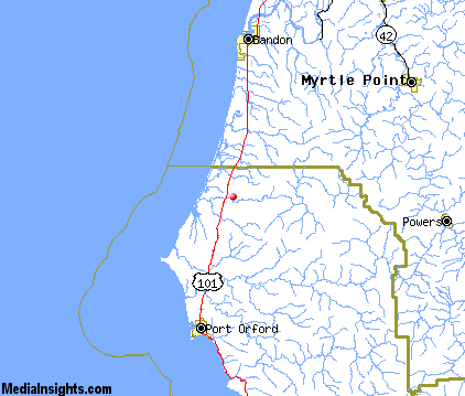
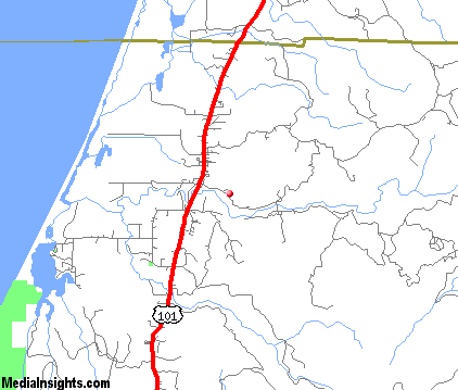
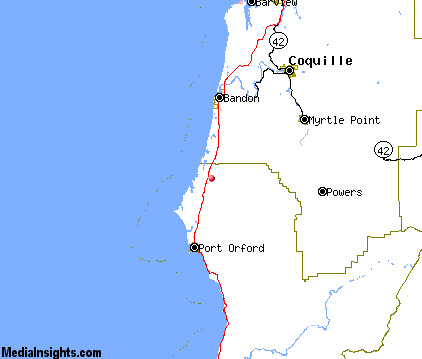
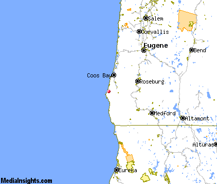
Langlois Map & Transportation
|

|
|
 |
|
|
| Click each thumbnail image to enlarge. |
 |
 |
 |
 |
The closest airports in the area are the Cape Blanco State airport (5S6) located about 5 miles southwest of Langlois in Denmark, Oregon, the North Bend Municipal airport (OTH) located approximately 36 miles northeast of Langlois in North Bend, Oregon, and finally the Illinois Valley airport (3S4) located roughly 68 miles southeast of Langlois in Cave Junction, Oregon.
|

|
Langlois Attractions
|

|
|
| | | Golf Courses |
| Bandon Dunes | Bandon | OR | 14.2 mi. | | | Bandon Face Rock Golf Course | Bandon | OR | 14.2 mi. | |
| | | Ski Areas |
| Mount Ashland | Ashland | OR | 101.3 mi. | | | Willamette Pass | Eugene | OR | 103.9 mi. | |
| | | State Parks |
| Port Orford Cedar Forest State Park | | OR | 5.4 mi. | | | Floras Lake State Park | | OR | 5.5 mi. | | | Cape Blanco State Park | | OR | 7.7 mi. | | | Bandon State Park | | OR | 9.3 mi. | | | Paradise Point State Park | | OR | 11.3 mi. | | | Port Orford Heads State Park | | OR | 12.6 mi. | | | Face Rock State Park | | OR | 12.8 mi. | | | Albert H Powers Memorial State Park | | OR | 16.1 mi. | | | Humbug Mountain State Park | | OR | 16.3 mi. | | | Bullards Beach State Park | | OR | 16.4 mi. | | | Coquille Myrtle Grove State Park | | OR | 17.5 mi. | | | Hoffman Memorial State Park | | OR | 18.5 mi. | | | Secen Devils State Park | | OR | 22.0 mi. | | | Sisters Rock State Park | | OR | 22.6 mi. | | | Cape Arago State Park | | OR | 26.7 mi. | | | Shore Acres State Park | | OR | 27.4 mi. | | | Sunset Bay State Park | | OR | 28.9 mi. | | | Geisel Monument State Park | | OR | 29.4 mi. | | | Yoakam Point State Park | | OR | 29.7 mi. | | | Otter Point State Park | | OR | 31.5 mi. | |
| | | Museums |
| Coos Art Museum | Coos Bay | OR | 33.2 mi. | (Art) |
| | | Zoos and Aquariums |
| Wildlife Safari | Winston | OR | 54.0 mi. | |
Notice a problem with the information on this page? Please notify us.
|
Disclaimer: We recommend you conduct your own research regarding all accomodations and attractions found on this website. The distances shown on this website are straight-line distances as the crow flies. The road distance may be considerably longer. You assume all liability for use of any information found on this website. No information is confirmed or warranted in any way. By using our services you agree to the terms and conditions of this disclaimer.
|
| We are the #1 site for your Oregon Vacations presenting Oregon vacation rentals, hotels, weather and map for each city. |
Oregon Vacations .com
©1997-2025 All Rights Reserved.
|
|